Tamilnadu Hill Stations
For Hill Station Tours CLICK HERE
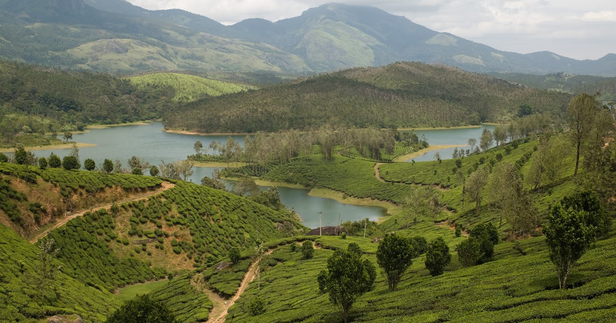
Ooty
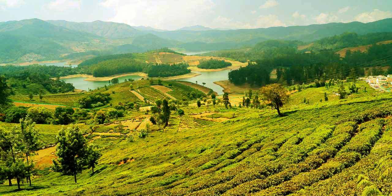
This is located in the Western Ghats zone at an altitude of 2240 mtrs. It is the headquarters of the Nilgiri District, where the two mountain ranges meet. Udhagamandalam , popularly called as OOTY by the tourist, is the Queen of Hill Stations. Centuries ago this was also called as Oththai-Kal [single stone] Mandu [ Mund is a name of Toda Village]. The British started calling it as Ootacamund. Coffee and Tea Plantations and trees like Conifers, Eucalyptus, Pine and Wattle dot the hill side in Udhagamandalam and its environs. Summer temperature is maximum of 25 C and a minimum of 10 C . During the Winter it is minimum 5 C and a maximum of 21 C when it is slightly warmer. This area was inhibited by the tribals called TODA long before any body could venture into this region. Curiously enough, this slice of paradise remained unknown even during the periods of the great Southern Dynasties. It was the Britons who ventured into the riches of the regions during early 1800’s. Development and modernization took after their arrival to Udhagamandalam. This was the Summer Capital of the Madras Presidency during the British Rule. Coonoor - 19Kms, Kothagiri - 31 Kms are the other smaller nearby hill stations.The Town population is 88,430(2011 census) and Nilgiri District population is 7,33,394(2011 census).
Kodaikanal
Legend starts with Lieutenant Ward, an Englishman, who climbed up from the Kunnavan village of Vellagavi to Kodaikanal in 1821 for a survey of Mountain Ranges of Palani. In 1834, J.C Wroughten, the then Sub-Collector of Madras and C. R. Cotton, Member - Board of Revenue - Madras Presidency went up the hills from Devadanapatti and built a small bungalow at the head of Adukkam pass near Shenbaganur. The visit of Dr.Wite in 1836 and his observation about the Hill Station attracted Botanists to Kodaikanal. First two houses named Sunnyside and Shelton, on the South Lake Road, were built between 1844-1845 by American Missionaries. Six more such American families migrated to Kodaikanal. Exotic location at 7000 feet above the Plains brought them up here.
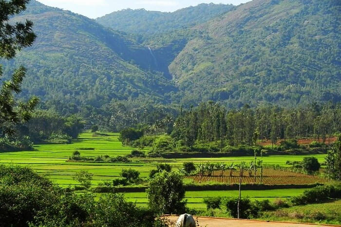
Yercaud

Yercaud is situated at an altitude of 4970 feet , on the Shevaroys Hills of the Eastern Ghats, located in Salem District of Northern Tamil Nadu. Because of the abundance of Trees and that happened to be near the Lake made the locals to call this area as Yeri – Kaadu meaning Lake Forest. Later on the name turned out to be YERCAUD and it is also called as Jewel of the South. Yercaud Taluk spreads in an about 382.67 Sq.km area which includes the Reserve Forest also. While rest of this region, including the predominantly short and rocky hills of the Eastern Ghats welcomes all with its cool climate. The temperature never rises above 290 and does not drop down below 130 degrees. Yercaud is less expensive than either Udhagamandalam or Kodaikanal. Yercaud population is 36,863 (2011 census).
Botanical Survey of India maintains an Orchidarium in Yercaud. Apart from this, Coffee plantations are a plenty here. Abundance of Orange Groves too are found in this region. Bananas, Pears, Jack Fruit and spices like Pepper are the other major production of this region . Scenically, Yercaud is an enchanting Hill Station on the Western Ghats and Trekking is the most enjoyable way to spend time. Bison, Deer, Rabbits, Hares, Foxes, Mongoose, Squirrels, Partridges, Snakes, Bulbuls, Kites, Sparrows, Swallows and the Bird of Paradise form the Wild Life habitats of Yercaud region. Places for sight-seeing include the Lake, Lay’s Seat, Killiyur Falls, Pagoda Point, Arthu’s Seat, Kaveri Peak and the Servarayan temple at 5,326 ft.Yelagiri
Yelagiri Hill is at an 1410 meters altitude, and one of the most popular hill stations of Tamil Nadu. Situated amidst four mountains well known for its salubrious climate prevailing throughout the year. Tribal people live in villages of these hills. Human settlement started around 200 years ago.
Travel by the winding Ghat road that has 14 hairpin bends, you can reach the Yelagiri hilltop. The ride offers panoramic breath taking views of the hills and its surroundings. The seventh bend is significant, since it offer the view of the slopes of the mountain and the green forests . The highest point in Yelgiri is the Swamimalai Hill, standing tall at 4,338 ft and a popular destination for trekkers. Yelagiri comprises of 14 small villages. The tribal inhabitants are engaged in agriculture, horticulture, forestry etc. Their traditions, habits and the structure of their houses are very unique and attract tourist’s attention. Ebenezer Matriculation and Higher Secondary Residential School, Peace Garden Matriculation School and Samaritan Residential School are some educational institutions cater to all categories of both Local and Outstation Students. The Don Bosco, has recently established an Arts and Science College for the benefit of local community.Anamalai Hills
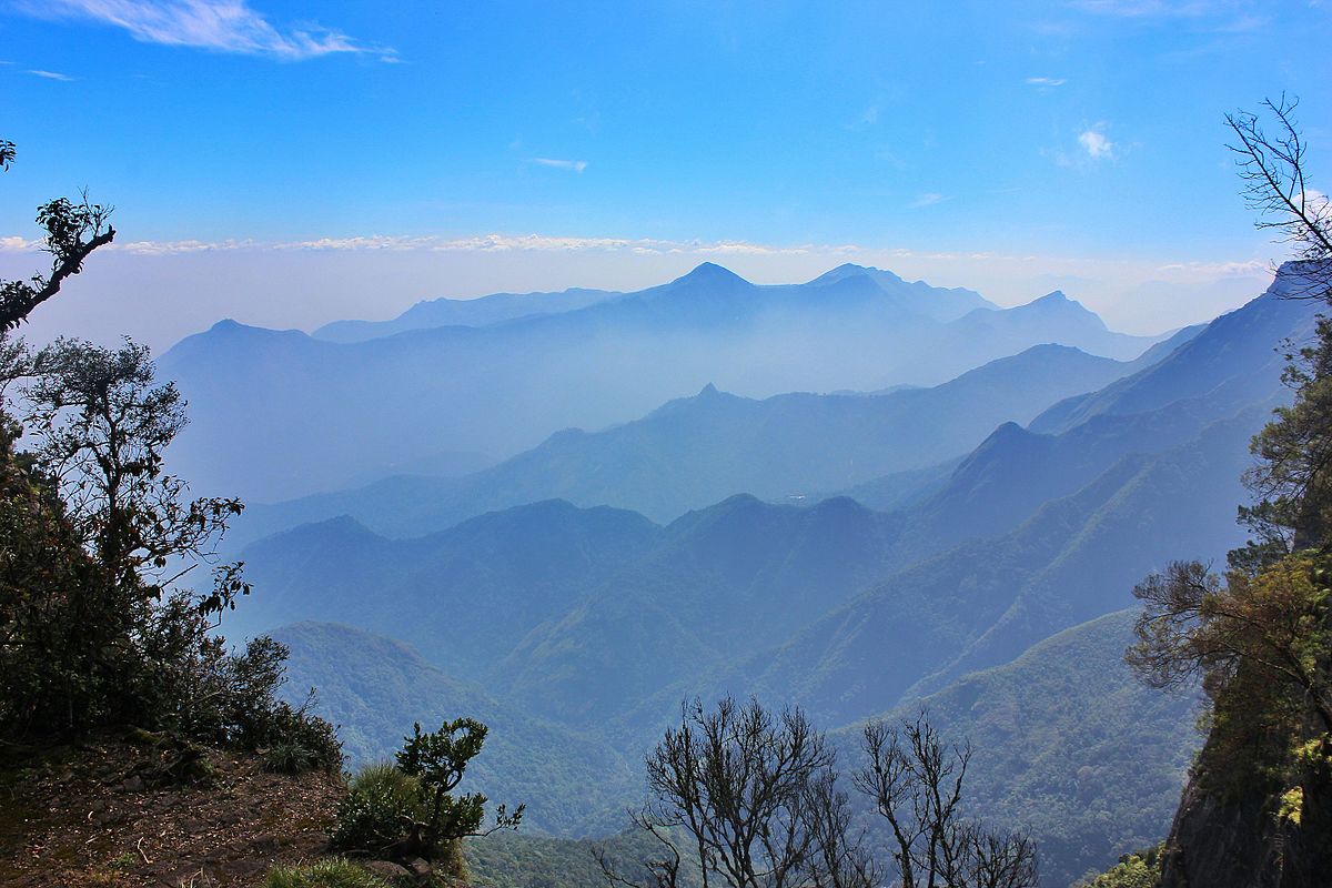
It is also called as Elephant Hills. It is a range of mountains in the Coimbatore District of Tamil Nadu, located along the Western Ghats, lying between 10° 13' and 10° 31' N. and 76° 52' and 77° 23' E. It is also the tallest of the hills in South India that rises up to 8850 ft. The geological formation is of metamorphic gneiss, veined with feldspars and quartz, and interspersed with reddish porphyrites. The Lower slopes yield valuable teak and other timber. In some areas, coffee plantations are a common sight. The area was notified as Anaimalai Wildlife Sanctuary in 1974 and established in 1976.
There is a 30 Km wide gap [big break in the Western Ghat mountain range] between the Nilgiri Hills to the north and the Anamalai Hills to the South that straddles the Kerala and Tamil Nadu border and serves as a major communication route between them. Highways and Rail Transport connect Palghat with Coimbatore and Pollachi. This huge gap is called as Palghat Gap.Kolli Hills
A serene and pristine mountain range, sited in the central Tamilnadu on the eastern ghats, 55 Kms from Namakkal district located at an ever-so-pleasant altitude ranging from 1000 to 1300 meters above mean sea level, Kolli hills enjoys a salubrious climate throughout the year. This fertile pocket in Namakkal district is where exotic tropical fruits and medicinal plants grow in plenty. The land is still relatively untouched by time, with 16 quaint little tribal villages that once constituted the historical hill Kingdom of Ori. Much of the charm of this hill country still remains mystical to probe.
This is one hill station where one does not feel the glacial cold of season, with a pleasing cool climate (temperature never rises above 30ºC or falls below 13ºC), hence can be visited any time of the year. For if you can’t stand the milling crowds of Ooty and Kodai, this surely is one place where you can head to for a quiet holiday.
Best Selling Tour Packages
Charming Hills Coastal Odyssey Southern Triangle Cultural Carnival Pilgrim Blessing Heritage Magic Wild Hills Misty Hills
Honeymoon Tour Packages
Extreme Privacy Romance @ Hills Amazing Love Love @ Coast Romantic Honeymoon Romantic Bug
Hill Station Tour Packages
Mist Valley Enchanting Hills Morning Drizzle Hills & Wildlife Wandering Hills Weekend Hills
Beach Tour Packages
Beach Fantasy Pristine Beaches Beach Wanderlust Sun N Sand Romance @ Coast Beach Nomad
Wildlife Tour Packages
Go Wild Love Tiger Amazing Wild Extreme Wilderness Wild @ Hills Wandering Wild
Temple Tour Packages
Temple Darshan Majestic Temples Magnificient Temples Historical Temples Temple Pilgrimage Vibrant Temples
Historical Tour Packages
Historical Splendor Historical Grandeur Historical Spectacle Historical Marvel Historical Glory Historical Beauty